Monday, July 15, 2019

Glacier National Park Day 2

Vanlog, Conrad, MT

This morning, I got up early (as usual) to beat the crowds at Logan Pass, arriving there around 7:30 AM. I did the 3-mile round-trip hike to Hidden Lake and saw a number of mountain goats along the way. Part of the trail was still under snow pack. 


The Garden Wall and Highland trails were closed due to bear activity. In fact, someone disappeared in the park not too long ago--a solo hiker, and it is suspected that a wild animal may have gotten him. 

After my hike, I drove out of the park through the St Mary entrance and then north to Babb and west along the Many Glacier Road. Here, I wanted to hike the 2-mi round-trip to Apikuni Falls. Although there were cars in the parking lot, I could see no one on the trail. So I waited 15 min for a car to pull in and met the most wonderful couple from Florida. I invited them to do the hike with me and we had wonderful conversation and took our time climbing the 600-ft elevation gain to the base of Apikuni Falls. The entire hike we were surrounded by bear grass and wildflowers. It was definitely a memorable hike. I finally found someone who takes even more photos than me!


After the waterfall hike, I drove to the Many Glacier Hotel, found a lucky parking spot someone had just vacated, and ran to the ticket office, where I was number 8 on a waitlist for the 2 PM scenic boat tour. For reference, I arrived at the ticket office at 1:55 PM. Due to cancellations and the fact that I was a party of one, I managed to get the very last ticket for a ride across Swiftcurrent Lake and Lake Josephine. 


It was about 5:00 PM when I arrived back in Babb. I started heading southeast toward the next major destination: Yellowstone national park, stopping at a rest area in Conrad, MT overnight. 

Glacier National Park Day 1

Vanlog, Avalanche Creek campground, Glacier NP, MT

Posted a day late

I spent the last two days exploring Glacier national park. Of the 58 national parks which I have seen, Glacier ranks in the Top 10, probably even int he Top 5. so I entered the park at 8 AM yesterday from West Glacier and set up camp in the Avalanche campground before exploring too much of the park. I drove over the amazing and somewhat scary Going to the Sun Road, stopping at various points along the way. My first stop was at Lake McDonald and McDonald Falls.


Then I hung out among the beargrass at the Weeping Wall turnout before heading over the 6646 ft Loan Pass to Sun Point, where I took the 0.6 mi trail to Baring Falls. Sun Point has an excellent view of St Mary Lake. 


The next stop was at Wild Goose Island, where I hiked down to the water. Later in the afternoon, I took a scenic boat tour of St Mary Lake which afforded me an even closer view of the island. 


I drove back west over the pass to my campsite for the evening. On the way back, there was a bear just off the road at Weeping Wall which entertained the passers-by for a while, me included. It was a nice cool evening sleeping. I did not even need to turn on the Max Air fan in the van.

Saturday, July 13, 2019

A scenic drive

Vanlog, Kalispell, MT

Despite a late night around the campfire with my new friends that stretched into the early hours of this morning, I woke naturally at 6:30 AM and quietly left the campsite by 7:00 AM. I drove into the town of McCall to tank up and update my blog from yesterday. Then I began the long journey toward Glacier national park--and what a journey it was! The theme of today's blog post is the incredible scenery. Starting in McCall, ID, I headed north on Rt 15 on one of the most scenic stretches of highway I have ever seen. On my left, just to my west, spanned the Seven Devils Mountains that serve as the eastern border to Hell's canyon (inaccessible to Vanna White and her low clearance underbelly) and to my right (the east) the road followed the northward course of the Little Salmon River until I reached the town of Riggins, ID. Here, the river joined with the Lower Salmon River as the road continued north along the edge of this amazing scenery to the town of White Bird, ID and then eventually to Grangeville, ID, a total distance of about 66 miles. The road was mostly empty at this hour and I felt incredibly relaxed as I meandered at my own pace without anyone on my back bumper. 


Highway 15 north follows part of the Nez Perce trail. The Nez Perce were nomadic Native Americans who alternated between their fishing spots along the Columbia River in Oregon and their bison hunting grounds to the east in the Yellowstone region. The Nez Perce trail, much like the more familiar Trail of Tears int eh East, is one of the darker chapters in American history. As more and more White settlers arrived in the region, the Nez Perce signed a treaty with the US government in 1855 which promised them most of their native lands. However, with the discovery of gold and the ensuing onslaught of miners that followed, the Nimiipuu (as they were known in their native language) were forced to sign a new treaty which diminished their territory to only 10% of its original area. However, several of the chiefs refused to renegotiate with the government and were considered the "non-treaty" Nez Perce. The non-treaty Nez Perce remained in their homeland until 1877 when the US Army came to force them onto their negotiated land. Ultimately, conflict broke out as several braves killed some settlers and livestock at an area called Tolo Lake (see photo below). Fearing retaliation, a number of chiefs, including Chief White Bird (for which this area is named) fled eastward with 700-900 Indians along present-day Highway 15. Here, they repulsed a much larger force of pursuing cavalry in the Battle of White Bird Canyon (see photos below). 


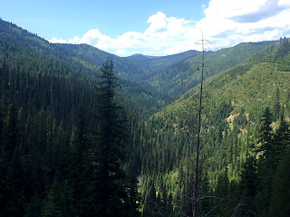
Continuing northeast from Grangeville, ID on Routes 13 and 12, I drove 126 miles of windy road along the even more scenic Middle Fork of the Clearwater River and then the Lochsa River. The Clearwater River is a beneficiary of the 1968 Act of Congress known as the National Wild and Scenic Rivers Act, which preventing the formation of a dam and allowed the Clearwater to flow unobstructed the way that it had for centuries. Because of how windy the road was, this section of my journey took many hours. 


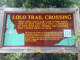
Finally, nearing the end of Route 12, the road rises steeply and abruptly from the riverbed to cross over the Bitterroot Mountains at Lolo Pass. This stretch of highway is also part of the Lewis and Clark Trail. In September of 1805, the Lewis & Clark Expedition encountered perhaps their most difficult stretch of terrain trying to cross the steep Bitterroot Mountains in the snow. Pummeled by a sudden thunderstorm and hail, they were forced to turn back. A week later, it was the Nez Perce who came to the aid of the starving Corps, feeding them, equipping them with horses, and guiding them over the Lolo Pass. Ironically, it was through this same pass that the non-treaty Nez Perce passed on their eastward journey to the Yellowstone region while being pursued by the US Army in 1877. Many of them perished when the Army caught up with them at the Big Hole Battlefield. 


Descending on the eastern side of the Lolo Pass (without any brake light problems despite the very steep descent), I arrived in Missoula, MT. Here, I followed Routes 93 and 35 north for 44 miles along the eastern edge of the picturesque Flathead Lake until reaching my final destination--a Walmart parking lot in Kalispell, MT by 7 PM. Approximately 11 hours on the road to cover 419 miles of incredibly scenic countryside. Thus ends another day on the "Vanna Trail" across this great country of ours. Tomorrow--Glacier National Park.


Beautiful Idaho

Vanlog, McCall, ID

I'm sorry I wasn't able to blog yesterday, but there was no cell service at my remote campground. Yesterday, I was still in McCall, ID, a gateway town to outdoor recreation. Those of you who know me know how much I love my national parks, but often there are state parks or national forests that are just as pretty and worthy as some of the national parks but without all the crowds. Such was the case here in and around McCall, where I arrived on Thursday night at Ponderosa State Park for the past two nights. Yesterday, I decided that I had reached the midway point of my trip and as far west as I was going ot go on this vacation. Thus, int he morning, I spent some time doing all those mundane things that you need to do on a long trip. I got the oil changed int he van, went food shopping, and did my laundry--all before 11 AM. Then I drove back tot he state park and did a short hike to a place overlooking Payette Lake called Osprey Cliff. After four days of 90-degree weather without a shower (it's not as gross as you think because I wash off every morning with a wet cloth), I decided to take a dip in the lake and enjoyed hanging out on the sandy beach there. Then I drove a little north of town to the Brundage Mountain Ski Resort, took the lift to the top and had panoramic views of the entire surroundings. To the east were the Sawtooth Moutnains where I had spent much of my Thursday, to the west the Hells Canyon area, and to the north I had views of Payette Lake. 


While I was in Omaha earlier on the trip visiting my friend Nicole, she had a house guest who had a cousin who lived in Boise. She told me if I was traveling out that way I should contact her, so I did and I shared this campsite int he state park with her, her husband, and their dog. They rolled in late Thursday night and had to do business on Friday, so I didn't get to connect really with them until Friday evening after I cooked a real dinner. We shared some beers and stories around the campfire late into the night. A true friend of a friend of a friend, but it's always great meeting new people on my travels. So many of them are really nice people on their own interesting journeys through life and it reminds me how at the core of it most people all share the same sorts of dreams. 

Friday, July 12, 2019

Sawtooth Mountains, Idaho

Vanlog, McCall, ID

I left my beautiful boondocking campsite in the Sawtooth National Forest after using their free dump station and filling up on my water. I drove north from Ketchum, ID to Stanley, ID over the Galena summit. This is steep mountain driving and my brake light came on several times even when I wasn't braking on the descents. The transmission seems to sense that I am going down a steep grade and downshifts for me. I stopped and topped up the brake fluid, but it was already int he middle anyway. The mechanic I asked said it was probably because the level goes down when you are on such a steep angle and then the sensor goes off. I had no problem stopping and my brakes did not smell at all. Just south of Stanley, there was a pull-off for Redfish Lake. I stopped and got a photo of the mountains reflected in the lake. This whole area is filled with amazing rivers, green water with white rapids here and there alongside the road the entire drive. I continued west from Stanley on Rt 24 and then north on Rt 15 to McCall, ID. 


I arrived in McCall at 2 PM and drove a long gravel road to a remote campground called the Northwest Passage. Here, I spent the afternoon relaxing, working on some edits for the second edition of my textbook, reading about molecular structure, and watching a movie (Perks of a Wallflower) on my laptop. My new friends (a friend of a friend of a friend) who were sharing the campsite with me did not arrive until 11 PM. 


Wednesday, July 10, 2019

Shoshone Falls

Vanlog, Sawtooth National Forest just north of Ketchum, ID

Last night, I woke at 3 AM and knowing that I was in one of the darkest national parks in the NPS, I went outside and laid on the picnic table looking up at the stars. I have never seen so many stars in my life. The Milky Way was clearly visible. Reflecting on the vastness of the universe and man's place in it is a very spiritual experience. I stayed outside until the mosquitoes got the better of me. Then I went back to bed.

I had breakfast in the van and left the campsite by 7 AM, heading west on US 40, then 80W toward Salt Lake City, UT. Then I headed north on 15 and west on 84 to Twin Falls. Here, I paid $5 to see the Niagara of the West, Shoshone Falls. It was a long 7.5-hr drive and the temperature had now reached 97 degrees, but it was totally worth it. Just standing there taking it all in, it is truly an awesome sight to behold. I enjoyed it much better than the highly commercialized Niagara Falls, one of nature's greatest scenes.


Then it was back on the road again north to the Sawtooth Mountains, where I finally made camp in the Sawtooth National Forest in my first real boondocking campsite off a gravel road about two miles east of Route 75 N. Today was a long driving day: 588 miles in 11 hours of driving!


Tuesday, July 9, 2019

Bookends in Colorado

Vanlog, Jansen, UT

Today was almost like two separate days; hence, the title "bookends." In the morning, I woke at 6:30 AM to frost on the windshield and 34 degrees. I was still in Timber Creek campground in Rocky Mountain National Park in northeastern CO. By night's end, the temperature had reached 94 degrees and I found myself at Dinosaur National Monument in northwestern CO over 250 miles away. 

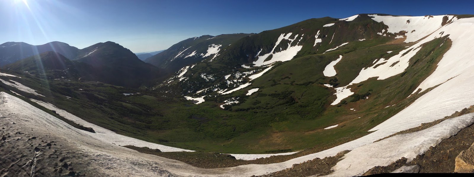
First, the morning. I left camp by 7 AM and drove back into the higher altitudes of Rocky Mountain NP along Trail Ridge Road, stopping at Lake Irene, Milner Pass (where the Continental Divide occurs), the Alpine Visitor Center at an elevation of 11,796 ft, Medicine Bow Curve, and Poudre Lake. 


I then drove south along Highway 34 through the Kawuneeche Valley portion of the park, seeing four elk and two moose along the way until I entered the town of Grand Lake. Here, I took a short hike to see Adams Falls before continuing my drive along the western edge of Lake Granby and then west on US 40 toward Steamboat Springs, CO. 


Much of the middle of my day looked like this, as I drove seemingly forever on 40W before arriving at Dinosaur National Monument. .


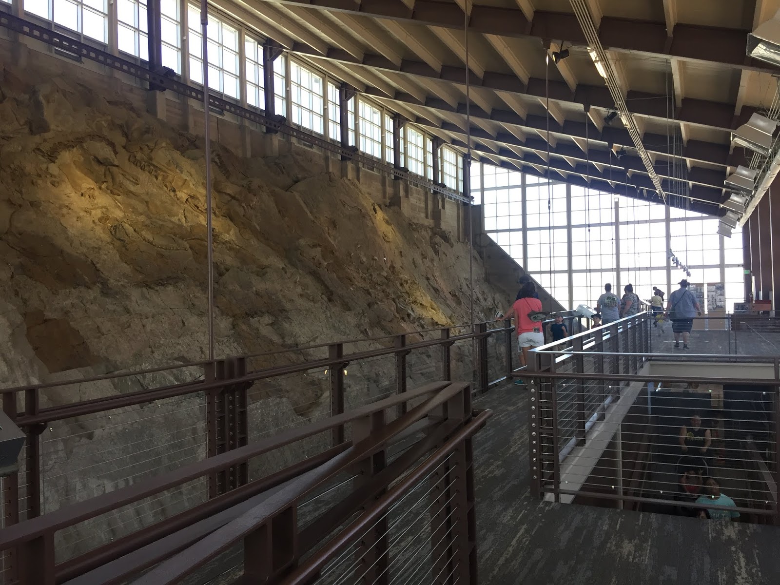
When we were at Dinosaur NM in 2010, it was a big "dud." We drove all the way out in the middle of nowhere to find that it was closed for renovations. Well, this time was not a dud! The renovations are complete and I was simply blown away by the Quarry Exhibit Hall, where you can see fossils of various types of dinosaurs from the Jurassic Period partially excavated in an air-conditioned exhibit hall. 


In addition to its famous dinosaur fossils, many of which wound up in the Carnegie Museum in Pittsburgh (mental note to visit on the drive home), Dinosaur NM is renowned for its Fremont Indian petroglyphs and its incredible scenery. Dinosaur was most definitely not a dud this time around!


Days 51 and 52: Chicago and Indiana Dunes NP

 Tuesday, July 2 We had a shower! The little luxuries in life that home dwellers take for granted! Then we were off for a long day of drivin...